

As a unique soil mapping system consistently gains popularity across Canada, a new researcher at DalÔÇÖs Faculty of Agriculture is thrilled to be able to bring his expertise on the subject to Atlantic Canada.
With the ever-growing need to better understand the worldÔÇÖs soil resources, the field of digital soil mapping (DSM) is rapidly growing. Brandon Heung, an assistant professor in geospatial informatics, primarily focuses his research on digital soil mapping and is excited for the field to become more widely recognized across Canada.
ÔÇťAlthough the field of digital soil mapping has been very active around the world over the last 25 years or so, it has really started to emerge in Canada over the last 10 years,ÔÇŁ Dr. Heung explains. ÔÇťI think that there are many opportunities to do digital soil mapping research in Canada and the upcoming years are going to be very exciting.ÔÇŁ
Creating soil maps
A soil map is a geographical representation of soil types and properties, such as textures, organic matter, and depths of horizons. There are a number of uses but soil maps are used largely by farmers, land users and policy makers. Digital soil mapping is essentially a method of creating soil maps using a number of computerized methods to better understand the characteristics and variability of soils.
A combination of soil science, statistics and geographical information systems (GIS), a computer system that calculates data related to positions on the EarthÔÇÖs surface, is used to create DSMs. These precise calculations generate accurate DSMÔÇÖs that can be used for land evaluation, spatial planning, agricultural extension, environmental protection and much more.
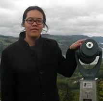 ÔÇťMaps of soil types and their attributes can be used for a whole host of different applications such as precision agriculture, forest resource inventory, carbon monitoring, soil assessments and so forth,ÔÇŁ says Dr. Heung (left).
Conventional methods of soil mapping saw soil scientists taking aerial photos of land and using a number of manual tools in the field to create a soil survey. Now, these time-consuming methods have been replaced with digital methods, making soil mapping much more time-efficient and accurate.
ÔÇťDSM takes advantage of the advances in computing power, GIS software, statistics and the availability of digital datasets like satellite imagery, drone-acquired data, climate models and more,ÔÇŁ says Dr. Heung. ÔÇťI honestly think that in the next five to seven years Canadians should start to see national soil mapping products. Those maps will be crucial inputs for hydrologic, climate and land-use models in the future.ÔÇŁ
Across the country
Born and raised in Vancouver, B.C., Dr. Heung began his academic journey at Simon Fraser University. He completed his B.Sc (Hons.) in 2011 and later received his PhD in April 2017. Since the completion of his PhD, he has been working as a postdoctoral fellow with Natural Resources Canada at the Great Lakes Forestry Centre in Ontario.
Although now conducting his research at Dal AC, Dr. Heung has many ongoing projects across the country under the broad theme ÔÇťDigital Soil Mapping Across Scales.ÔÇŁ At the farm-scale, Dr. Heung is involved with a precision agriculture project with the University of Saskatchewan. This project uses drone-acquired Light Detection and Ranging (LiDAR) data, a surveying method using pulsed laser lights to create 3D image maps.
Dr. Heung also has ongoing projects in BC (Simon Fraser University and BC Ministry of Forests, Lands, and Natural Resource Operations) where he works with colleagues to develop and test various mapping approaches for provincial-scale mapping of soils. They recently completed maps of soil classes and organic carbon stocks and are hoping to transfer some of these methodologies to Atlant